
ILC in the Field: Drones, Data, and the Delta, A Field Day in Myrtle Grove
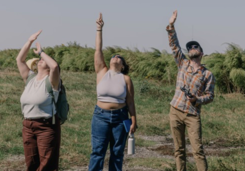
If you want to explain why geography matters to students, you can point at a map. Or you can hand them propellers, batteries, flight plans, and a sky. This ILC in the Field excursion took the second path. When Liz Camuti invited me to join a collaborative workshop in Myrtle Grove with the UPenn EM-Lab team, students from Tulane's Landscape Architecture program, and colleagues from River Science and Coastal Engineering, I jumped at the chance. The goal was old school and new school at once: learn what the land is doing and teach how to see it.
A living classroom at the edge of Louisiana
Myrtle Grove sits in Plaquemines Parish, the parish that shaped my childhood, where the highway narrows, the marsh widens, and the horizon becomes a rumor. Locals call a trip south "going down the road," said quickly, DTR, as if the syllables should know how to swim. I grew up farther down. After hurricanes reshaped too much of what we knew, my family moved upriver. For a few years they lived in Myrtle Grove. Hurricanes reshaped that, too. The coast edits, relentlessly.
So when Liz invited me to join her field workshop with the UPenn EM-Lab visitors, I said yes immediately. Liz is faculty in Tulane's Landscape Architecture program, which represents an exciting direction for the university. She and I have been collaborating on the bones of a Geographic Information Systems and Remote Sensing course tailored for designers who must work where water, sediment, and people argue for a living. The idea is simple: give landscape students the same analytic tools that engineers and scientists use, then ask them to design with reality's grain, not against it. That vision folds neatly into the program's Digital Media sequence and the advanced Spatial Data Analysis course that bridges Landscape, River Science, and Coastal Engineering, including drone operations and LiDAR data processing that lead to design decisions instead of pretty pictures.
Myrtle Grove is not a postcard. It's a diagnostic. You can watch subsidence in slow motion and storm memory in fast forward. Sediment gets starved. Marsh fragments. Shorelines slur. Every year redraws a childhood fishing map. The workshop plan was to collect UAV data over representative ground and water surfaces, establish ground control, and stitch the result into georeferenced models. On day two, the in-class portion would focus on Pix4D processing, quality checks against the control points, and basic interpretation for students who will carry these methods into studios and research.

The instruments and the plan
The UPenn EM-Lab team brought a compact prosumer rig for demonstration flights: a DJI Mavic Pro configured for multispectral data acquisition and paired with a survey workflow that relied on ground control points, placed and measured so the processors would have truth to bend toward. In the classroom, those students would get to see how a few centimeters of positional honesty can scrub a model clean of the little lies that creep in when wind, light, and pixels conspire.
I brought Tulane's River Science and Coastal Engineering group the larger workhorse: a DJI Matrice 350 RTK fitted for LiDAR and photogrammetry missions. RTK means the craft knows where it is with startling confidence. LiDAR means the craft can see structure where cameras see color. Together, those tools turn air into information and then into elevation models, point clouds, and orthomosaics that a student can measure, not just admire.
We laid out a simple flight matrix. Wide area passes for photogrammetry. Lower altitude strips for higher density. A LiDAR run to read the shape of the bank, the edge of the channel, and the low places where water prefers to settle when nobody is looking. I quickly previewed the controller screens so students could see the point cloud arriving, just as data usually appears before it makes sense.

Teaching in stereo: engineering and landscape thinking
Why bring Landscape Architecture, River Science, and an external research lab together on a Monday? Because design without measurement is taste, and measurement without design is a spreadsheet. We want students who can do both, then talk about both to a neighbor who speaks a different dialect of problem-solving.
Tulane's curricular frame for this work already exists. In the Landscape Architecture sequence, Digital Media builds core representational tools, then pushes into dynamic storytelling about processes and time. Students move beyond static plans into animation, simulation, and interactive narratives that reveal how landscapes change and why. That training prepares students to communicate phenomena like drainage, erosion, and hydrology in formats the public and policymakers can understand.
On the engineering side, the Spatial Data Analysis course makes UAVs, LiDAR, and advanced GIS the main act, not a curiosity. Students plan flights, collect and process data, generate DEMs, inspect error budgets, and integrate datasets for real environmental decisions.
A grant, a coastline, a personal stake
I work with the MissDelta project, the Mississippi Delta Transitions Initiative, a multi-institution effort focused on the Bird's Foot and adjacent wetlands. The project studies sediment, sea level rise, subsidence, the plumbing of the river, and the hard truth that the coast moves, with or without our permission. The point of our drone and LiDAR surveys is to give the modelers a better floor and the planners a better map. My role straddles the technical and the human.
The coast is personal to me. I learned to steer by water towers. I learned that gas stations can feel like port cities. Hurricanes erased homes, closed schools, and changed where my family slept at night. If I can bring students into that landscape and show them how to see it in detail, then ask them to imagine repairing it with both humility and precision, that's work worth doing.
Credit where it's due
Thank you to Liz Camuti for the invitation and for her work building a rigorous and generous curriculum in Landscape Architecture. Her program's visualization and methods sequence aligns naturally with this kind of fieldwork and post-processing, and it plays well with River Science and Coastal Engineering coursework that puts instruments and analysis directly into students' hands.
Thank you to the UPenn EM-Lab visitors for sharing workflow discipline and for demonstrating that good habits travel well. Thanks to the students who asked the right questions in the right tone: curious, skeptical, and patient.
The broader frame: MISS DELTA and beyond
If you want to place this work inside a wider map, visit the Mississippi Delta Transitions Initiative to see how community, modeling, and field teams are working together across institutions on the Bird's Foot and the coastal systems that depend on it: missdelta.org. The project partners include Tulane University and LSU among others, because a coastline like this requires a coalition. Our drone work feeds modelers who build forecasts. Those forecasts feed planners who negotiate what can be saved and where. The public deserves to see the evidence behind the choices, and students deserve to build those evidentiary skills early.

